
Biomes
Maps and interactive tools relating to
the biomes of the world.
Interactive Biome Map on the Carbon Mapper
This tool overlays the global biome map* (as well as many other datasets) onto an interactive mapserver.Explore Carbon Mapper
Instructions for use (click to download the pdf version):
1. In the right hand panel, select a background of your choice (roads, terrain, satellite).
2. Then select GLOBE Carbon Cycle, then WWF Biome Map.
3. Navigate by clicking on map and dragging or zooming to the location of interest. You may want to turn off the biome map layer during navigation to see the background image better.
4. Click on the 'legend' tab to see the color coding of the biome map.
5. If you are not sure of the color, click on the 'i' tool on the lefthand panel, now when you click on the map it will pop up the name of the biome at that location.
6. When you find your location of interest, make note of the latitude and longitude displayed at the bottom of the map - you may need this later!
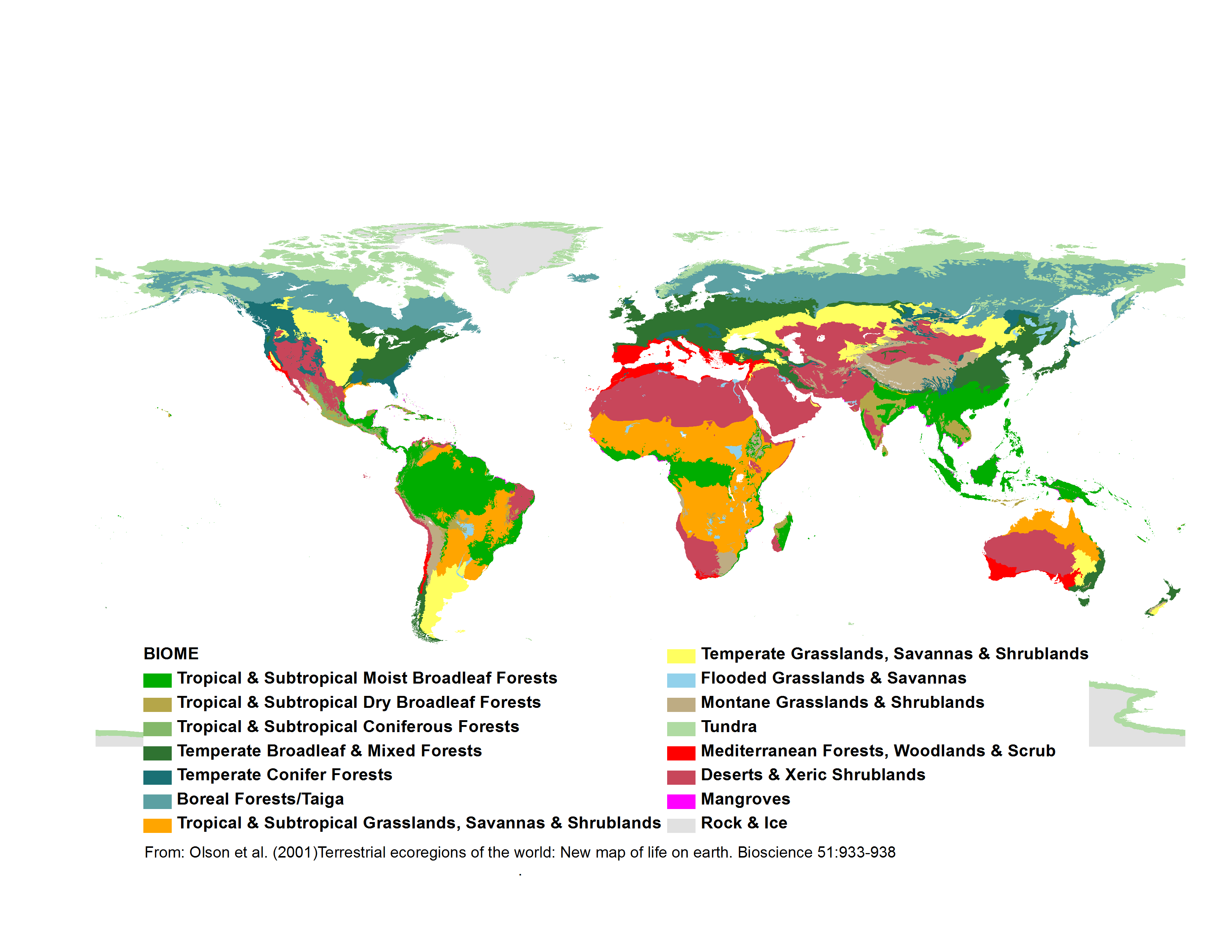
Printable Biome Map
Download your own copy of the global biomes map developed by Olson et al. (2001)*.Biome PNG
Biome Map with Climate Data
Temperature and precipitation graphs for selected biomes.Biomes and Climate PDF
You will need Acrobat Reader to view PDF documents. Download
Acrobat for free here.
*Olson et al. (2001). Terrestrial Ecoregions
of the World: New Map of Life on Earth. Bioscience
51:933-938.